|
|
EVALUATION OF AVAILABLE SIGHT DISTANCE IN HIGHWAYS USING GEOGRAPHIC INFORMATION SYSTEMS(VISCASIG) |
|

DEVELOPED SOFTWARE
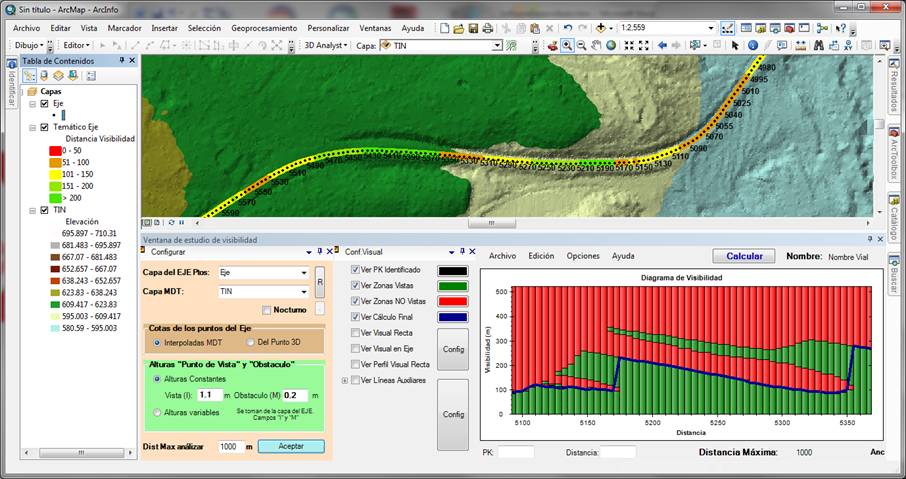
GIS-based Software has been developed that enables the estimation of available sight distance along a set of points defining a vehicle path. Once installed, this Add-on application could be added to any toolbar as a button within ArcGIS 10 environment. Besides a set of points defining a standard vehicle path (shape format or FeatureClass within a Geodatabase), it requires a Digital Elevation Model (DEM) (TIN format).

When starting up the Add-on, a new Sight-distance studies window opens. Such window comprises two areas: calculation settings (vehicle path, DEM, driver’s eye height, target height and maximum distance analyzed) and display settings (lines and colors displayed) on the left; and, when the calculation process ends, the output on the right (Sight-distance diagram). Also, results can be presented on Arcmap general view.